

GIVE THE PERFECT GIFT
Erin Mills Town Centre Gift Cards are the perfect choice for your gift giving needs.Purchase gift cards at kiosks near the food court or centre court, at Guest Services, or click below to purchase online.PURCHASE HEREHome
A History of Britain in 100 Maps
Indigo
Loading Inventory...
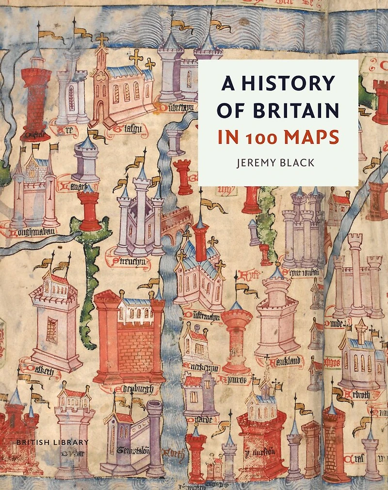
A History of Britain in 100 Maps
Current price: $88.00

A History of Britain in 100 Maps
Current price: $88.00
Loading Inventory...
Size: Hardcover
*Product information may vary - to confirm product availability, pricing, shipping and return information please contact Indigo
In A History of Britain in 100 Maps Jeremy Black takes readers deep into the unparalleled collections of the British Library Map Room to tell a new story of the British Isles through acknowledged treasures and previously undiscovered and unpublished items.
Presenting in detail 100 important maps Black explores major themes in British history, from settlement, environmental change, state formation and ecclesiastical development to industrialisation, urbanisation, and modern socio-political developments. In doing so he also tells the story of how a rich mapmaking tradition developed from the medieval Mappa Mundi to the work of pioneering cartographers including Matthew Paris, John Speed and Christopher Saxton and on through institutions such as the Ordnance Survey and the A– Z Company. Cartographic records of the Civil War and Great Fire, or curiosities including Emil Reich’ s ‘ Map of British Genius’ , are contrasted with infographic maps of recent elections and the COVID-19 epidemic. The book also considers the growing field of fine and digital artists using delineated images of Britain as their subject matter.
In A History of Britain in 100 Maps Jeremy Black takes readers deep into the unparalleled collections of the British Library Map Room to tell a new story of the British Isles through acknowledged treasures and previously undiscovered and unpublished items.
Presenting in detail 100 important maps Black explores major themes in British history, from settlement, environmental change, state formation and ecclesiastical development to industrialisation, urbanisation, and modern socio-political developments. In doing so he also tells the story of how a rich mapmaking tradition developed from the medieval Mappa Mundi to the work of pioneering cartographers including Matthew Paris, John Speed and Christopher Saxton and on through institutions such as the Ordnance Survey and the A– Z Company. Cartographic records of the Civil War and Great Fire, or curiosities including Emil Reich’ s ‘ Map of British Genius’ , are contrasted with infographic maps of recent elections and the COVID-19 epidemic. The book also considers the growing field of fine and digital artists using delineated images of Britain as their subject matter.
You May Also Like









More About Indigo at Erin Mills Town Centre
The largest book retailer in Canada also offers toys, music, home décor, gifts and lifestyle products. What's Inside...Books, Magazines, CD’s and DVD’s, Toys and Gifts, Home Accents, Electronics, Baby’s and Children’s Section, Bath and Body, Kitchen and Bedroom, Stationary Located outside in the exterior plaza.
5015 Glen Erin Dr, Mississauga, ON L5M 0R7, Canada
Find Indigo at Erin Mills Town Centre in Mississauga ON
Visit Indigo at Erin Mills Town Centre in Mississauga ON