
GIVE THE PERFECT GIFT
Erin Mills Town Centre Gift Cards are the perfect choice for your gift giving needs.Purchase gift cards at kiosks near the food court or centre court, at Guest Services, or click below to purchase online.PURCHASE HEREHome
Atlas of the Irish Rural Landscape
Indigo
Loading Inventory...
Atlas of the Irish Rural Landscape
Current price: $91.00

Atlas of the Irish Rural Landscape
Current price: $91.00
Loading Inventory...
Size: Hardcover
*Product information may vary - to confirm product availability, pricing, shipping and return information please contact Indigo
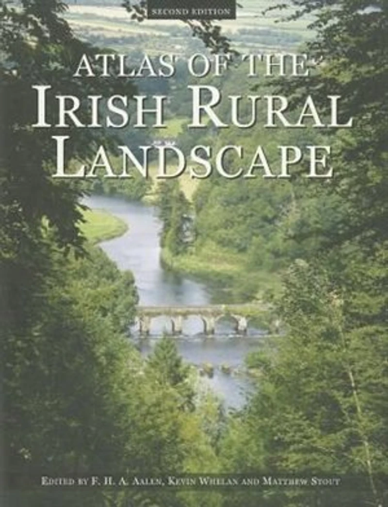
The second edition of Atlas of the Irish Rural Landscape is a magnificently illustrated, beautifully written, and thoroughly updated introduction to the hidden riches of the Irish landscape. Topics include archaeology, field and settlement patterns, houses, demesnes, villages and small towns, monuments, woodland, bogs, roads, canals, and a host of other features. The Atlas combines superbly chosen illustrations and cartography with a text amenable to a general reader. Hundreds of maps, diagrams, photographs, and paintings present accessible information suitable for any school, college, or home. New content in the contemporary section takes into account the Celtic Tiger and explores six fresh case studies - Tory Island (Donegal), the Wicklow Uplands, Inistiogue (County Kilkenny), Aughris (County Sligo), Clonfert (County Galway), and Point Lance in Newfoundland. This second edition of the award-winning Atlas of the Irish Rural Landscape continues to increase the visibility of the landscape within national heritage while establishing a proper basis for conservation and planning.
The second edition of Atlas of the Irish Rural Landscape is a magnificently illustrated, beautifully written, and thoroughly updated introduction to the hidden riches of the Irish landscape. Topics include archaeology, field and settlement patterns, houses, demesnes, villages and small towns, monuments, woodland, bogs, roads, canals, and a host of other features. The Atlas combines superbly chosen illustrations and cartography with a text amenable to a general reader. Hundreds of maps, diagrams, photographs, and paintings present accessible information suitable for any school, college, or home. New content in the contemporary section takes into account the Celtic Tiger and explores six fresh case studies - Tory Island (Donegal), the Wicklow Uplands, Inistiogue (County Kilkenny), Aughris (County Sligo), Clonfert (County Galway), and Point Lance in Newfoundland. This second edition of the award-winning Atlas of the Irish Rural Landscape continues to increase the visibility of the landscape within national heritage while establishing a proper basis for conservation and planning.
You May Also Like







More About Indigo at Erin Mills Town Centre
The largest book retailer in Canada also offers toys, music, home décor, gifts and lifestyle products. What's Inside...Books, Magazines, CD’s and DVD’s, Toys and Gifts, Home Accents, Electronics, Baby’s and Children’s Section, Bath and Body, Kitchen and Bedroom, Stationary Located outside in the exterior plaza.
5015 Glen Erin Dr, Mississauga, ON L5M 0R7, Canada
Find Indigo at Erin Mills Town Centre in Mississauga ON
Visit Indigo at Erin Mills Town Centre in Mississauga ON