
GIVE THE PERFECT GIFT
Erin Mills Town Centre Gift Cards are the perfect choice for your gift giving needs.Purchase gift cards at kiosks near the food court or centre court, at Guest Services, or click below to purchase online.PURCHASE HEREHome
Calgary & Southern Alberta Street Atlas
Indigo
Loading Inventory...
Calgary & Southern Alberta Street Atlas
Current price: $29.95

Calgary & Southern Alberta Street Atlas
Current price: $29.95
Loading Inventory...
Size: Paperback
*Product information may vary - to confirm product availability, pricing, shipping and return information please contact Indigo
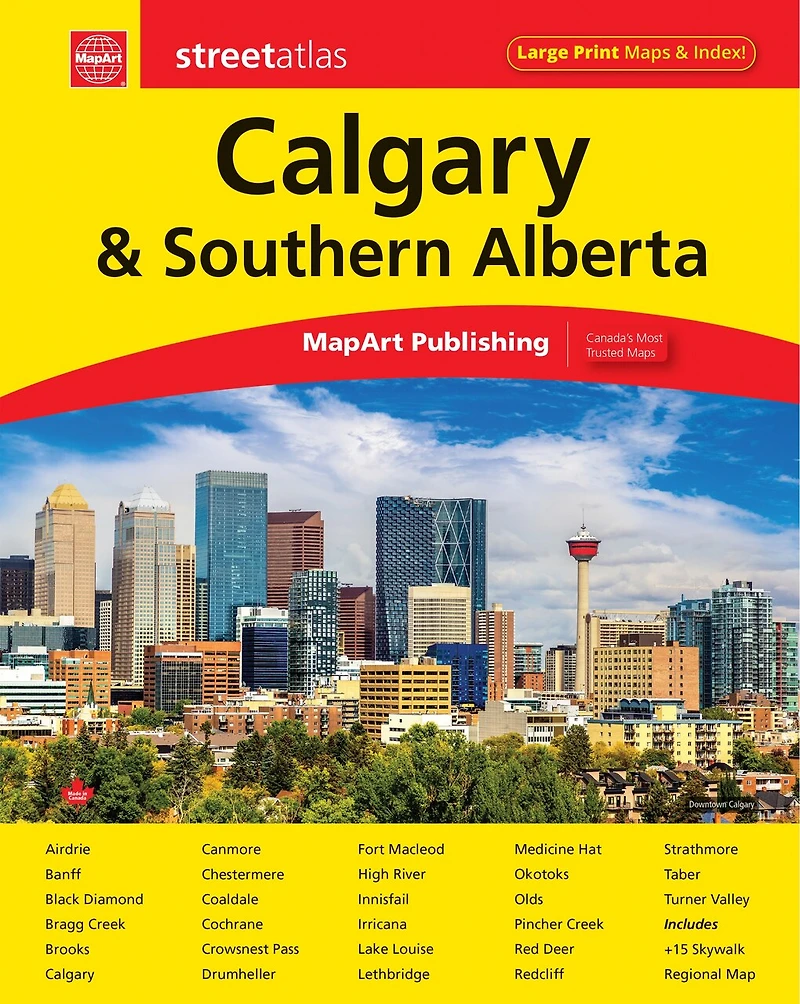
It’s the definitive auto companion for travel in this area, whether you are a resident or short-term visitor. It’s got all the features to make even the unfamiliar areas easy to navigate.
Inside this 152 page atlas you will find locator maps, feature listings (points of interest, hospitals, airports, golf clubs and universities and colleges), downtown Calgary map (1:10,000), regional maps (1:250,000), city maps (1:21,000), Alberta distance chart and a detailed street index.
City mapping includes Airdrie, Banff, Black Diamond, Bragg Creek, Brooks, Calgary, Canmore, Chestermere, Coaldale, Cochrane, Crowsnest Pass, Drumheller, Fort Macleod, High River, Innisfail, Irricana, Lake Louise, Lethbridge, Medicine Hat, Okotoks, Olds, Pincher Creek, Red Deer, Redcliff, Strathmore, Taber and Turner Valley.
The detailed city map features include divided highways, major roads, secondary roads, main thoroughfares, minor streets, lanes / private streets, interchange numbers, one way streets, street address numbers, trans-canada highway—yellowhead route, railways, VIA Rail stations, C Train, bus only streets, municipal boundaries, recreation trails, parks / conservation areas, golf courses, commercial areas, cemeteries, institutional areas, industrial areas, special attraction areas, Indian reserves, National Defence areas, hospitals, tourist information centres, police stations, fire halls, libraries, points of interest, off leash dog parks, national parks / historic sites, arenas, community / recreation centres, pools, baseball, soccer, tennis, skiing, campgrounds, public and catholic schools
The detailed regional map features include expressways and roads including highways, roads, paved and unpaved roads, unimproved roads, seasonal roads and more. Other map features include airports, hospitals,tourist information centres, rest areas, skiing, golf courses, points of interest, landmarks, campgrounds, peaks, National parks, provincial parks, Indian reserves, populations and much more.
Wire-O bound
Dimensions: 22 x 28 cm (8.6875 x 10.875 inches)
Proudly made in Canada!
Provinces/Territories: Alberta
It’s the definitive auto companion for travel in this area, whether you are a resident or short-term visitor. It’s got all the features to make even the unfamiliar areas easy to navigate.
Inside this 152 page atlas you will find locator maps, feature listings (points of interest, hospitals, airports, golf clubs and universities and colleges), downtown Calgary map (1:10,000), regional maps (1:250,000), city maps (1:21,000), Alberta distance chart and a detailed street index.
City mapping includes Airdrie, Banff, Black Diamond, Bragg Creek, Brooks, Calgary, Canmore, Chestermere, Coaldale, Cochrane, Crowsnest Pass, Drumheller, Fort Macleod, High River, Innisfail, Irricana, Lake Louise, Lethbridge, Medicine Hat, Okotoks, Olds, Pincher Creek, Red Deer, Redcliff, Strathmore, Taber and Turner Valley.
The detailed city map features include divided highways, major roads, secondary roads, main thoroughfares, minor streets, lanes / private streets, interchange numbers, one way streets, street address numbers, trans-canada highway—yellowhead route, railways, VIA Rail stations, C Train, bus only streets, municipal boundaries, recreation trails, parks / conservation areas, golf courses, commercial areas, cemeteries, institutional areas, industrial areas, special attraction areas, Indian reserves, National Defence areas, hospitals, tourist information centres, police stations, fire halls, libraries, points of interest, off leash dog parks, national parks / historic sites, arenas, community / recreation centres, pools, baseball, soccer, tennis, skiing, campgrounds, public and catholic schools
The detailed regional map features include expressways and roads including highways, roads, paved and unpaved roads, unimproved roads, seasonal roads and more. Other map features include airports, hospitals,tourist information centres, rest areas, skiing, golf courses, points of interest, landmarks, campgrounds, peaks, National parks, provincial parks, Indian reserves, populations and much more.
Wire-O bound
Dimensions: 22 x 28 cm (8.6875 x 10.875 inches)
Proudly made in Canada!
Provinces/Territories: Alberta
You May Also Like











More About Indigo at Erin Mills Town Centre
The largest book retailer in Canada also offers toys, music, home décor, gifts and lifestyle products. What's Inside...Books, Magazines, CD’s and DVD’s, Toys and Gifts, Home Accents, Electronics, Baby’s and Children’s Section, Bath and Body, Kitchen and Bedroom, Stationary Located outside in the exterior plaza.
5015 Glen Erin Dr, Mississauga, ON L5M 0R7, Canada
Find Indigo at Erin Mills Town Centre in Mississauga ON
Visit Indigo at Erin Mills Town Centre in Mississauga ON