Home
Cardiff A-Z Street Atlas: Accurate street map for easy navigation by A-z Maps, Perfect | Indigo Chapters
Indigo
Loading Inventory...
Cardiff A-Z Street Atlas: Accurate street map for easy navigation by A-z Maps, Perfect | Indigo Chapters
From A-z Maps
Current price: $19.99
From A-z Maps
Cardiff A-Z Street Atlas: Accurate street map for easy navigation by A-z Maps, Perfect | Indigo Chapters
Current price: $19.99
Loading Inventory...
Size: 16 x 215 x 260
*Product information may vary - to confirm product availability, pricing, shipping and return information please contact Indigo
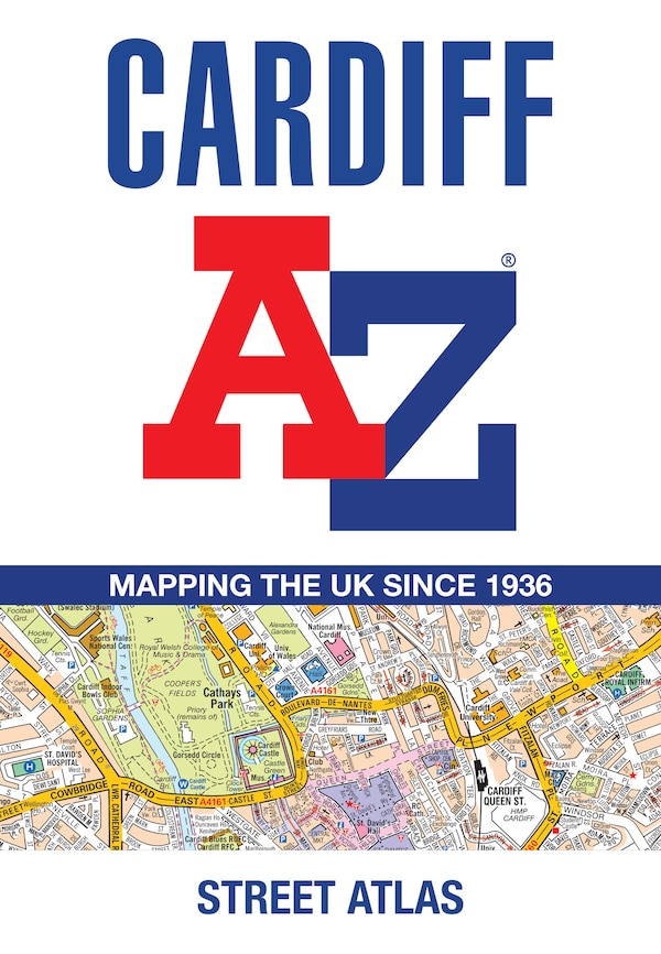
Navigate your way around Cardiff with this detailed and easy-to-use A-Z Street Atlas. Printed in full-colour, paperback format, this atlas contains 107 pages of continuous street mapping. The main mapping covers Cardiff and Newport at a scale of 4 inches to 1 mile, featuring postcode districts, one-way streets, park and ride sites, and safety camera locations. Areas covered include:PontypriddCaerphillyCwmbranPontypoolCaerleonPenarthBarryRhooseLlantwit MajorSeparate coverage of Chepstow, Caldicot, Magor and Cowbridge is provided. The large-scale street map of Cardiff city centre – at a scale of 8 inches to 1 mile – includes:Postcode map of the Cardiff areaRoad map of the Cardiff areaWaterbus stopsA comprehensive index lists streets, selected flats, walkways and places of interest, place, area and station names. Additional healthcare (hospitals, walk-in centres and hospices) are indexed as well. | Cardiff A-Z Street Atlas: Accurate street map for easy navigation by A-z Maps, Perfect | Indigo Chapters
Navigate your way around Cardiff with this detailed and easy-to-use A-Z Street Atlas. Printed in full-colour, paperback format, this atlas contains 107 pages of continuous street mapping. The main mapping covers Cardiff and Newport at a scale of 4 inches to 1 mile, featuring postcode districts, one-way streets, park and ride sites, and safety camera locations. Areas covered include:PontypriddCaerphillyCwmbranPontypoolCaerleonPenarthBarryRhooseLlantwit MajorSeparate coverage of Chepstow, Caldicot, Magor and Cowbridge is provided. The large-scale street map of Cardiff city centre – at a scale of 8 inches to 1 mile – includes:Postcode map of the Cardiff areaRoad map of the Cardiff areaWaterbus stopsA comprehensive index lists streets, selected flats, walkways and places of interest, place, area and station names. Additional healthcare (hospitals, walk-in centres and hospices) are indexed as well. | Cardiff A-Z Street Atlas: Accurate street map for easy navigation by A-z Maps, Perfect | Indigo Chapters