GIVE THE PERFECT GIFT
Erin Mills Town Centre Gift Cards are the perfect choice for your gift giving needs.Purchase gift cards at kiosks near the food court or centre court, at Guest Services, or click below to purchase online.PURCHASE HEREHome
Yorkshire Wolds Way by A-Z Maps, Perfect | Indigo Chapters
Indigo
Loading Inventory...
Yorkshire Wolds Way by A-Z Maps, Perfect | Indigo Chapters
By A-Z Maps
Current price: $19.99

By A-Z Maps
Yorkshire Wolds Way by A-Z Maps, Perfect | Indigo Chapters
Current price: $19.99
Loading Inventory...
Size: 3 x 240 x 100
*Product information may vary - to confirm product availability, pricing, shipping and return information please contact Indigo
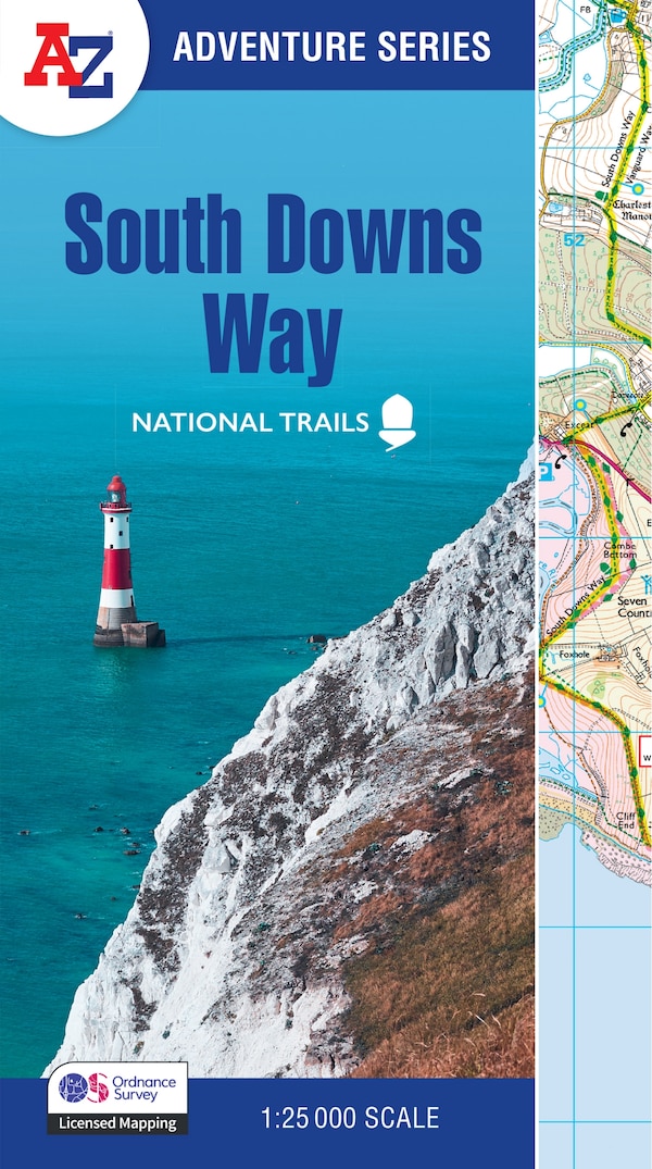
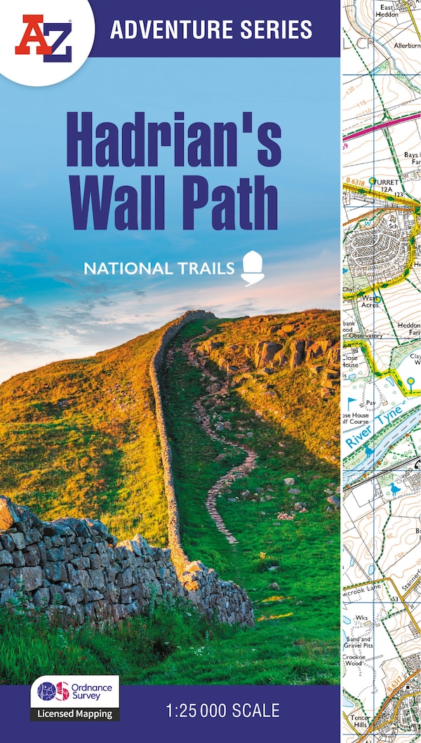
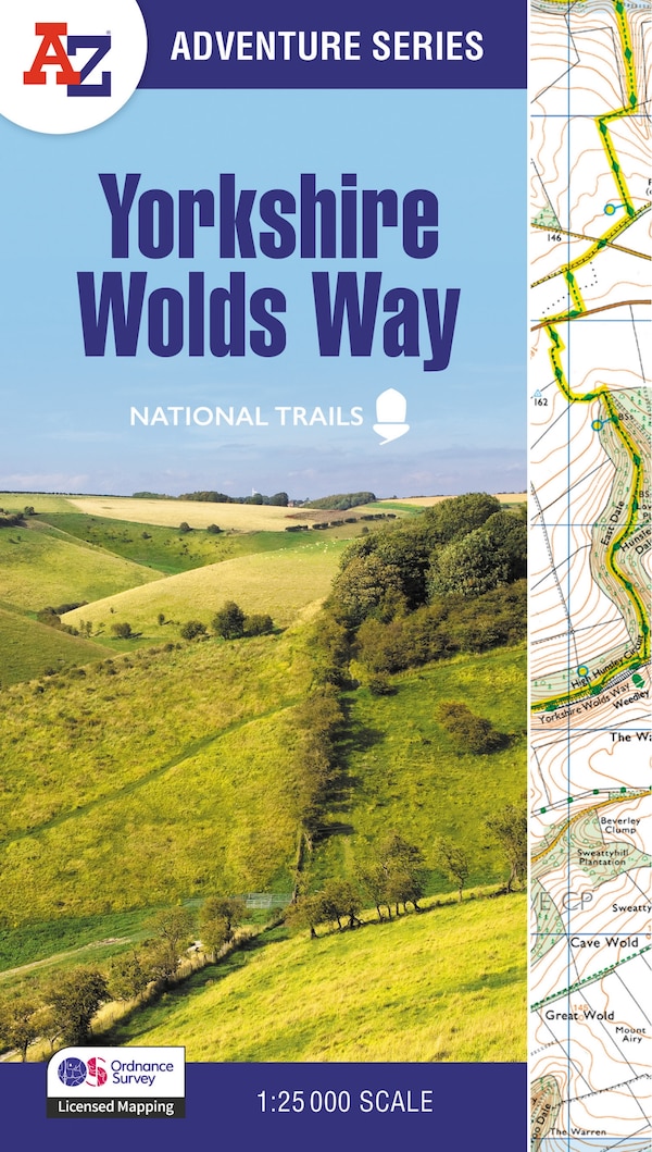
The A-Z Adventure Series of maps combines the best of OS and A-Z, creating the perfect companion for walkers, off-road cyclists, horse riders and anyone wishing to explore the great outdoors. The Yorkshire Wolds Way is a 79 mile (127 km) National Trail from the River Humber to the seaside resort of Filey. Crossing a tranquil landscape, the path encounters gently rolling chalk hills with easy climbs, isolated dry valleys, undulating fields and charming villages. The route on the map is clearly highlighted in yellow with mileage markers to gauge distances when planning sections of the walk to enjoy. This National Trail Map of the Yorkshire Wolds Way features 30 pages of continuous Ordnance Survey 1:25 000 mapping providing complete coverage of the Yorkshire Wolds Way. The atlas includes a route planner showing distances between places and the amenities available, featuring:Information CentresHotels/B&BsYouth HostelsCampsites (seasonal opening)Pubs, shops, restaurants, and cafes (seasonal opening)Petrol StationsAlso featured is advice on safety and security when walking and the Countryside Code. Unlike the original OS sheets, this A-Z Adventure Atlas includes a comprehensive index to towns, villages, hamlets and locations, natural features, nature reserves, car parks and youth hostels, making it easy to find the required location quickly. Each index entry has a page reference and a six figure National Grid Reference. With a book size of 240mm x 134mm it is the same size as the standard OS folded map. Other National Trails available within the A-Z Adventure series include: Cotswold Way, Hadrian's Wall Path, Norfolk Coast Path & Peddars Way, Pembrokeshire Coast Path, Offa’s Dyke Path, South Downs Way, SW Coast Path, and Thames Path. | Yorkshire Wolds Way by A-Z Maps, Perfect | Indigo Chapters
The A-Z Adventure Series of maps combines the best of OS and A-Z, creating the perfect companion for walkers, off-road cyclists, horse riders and anyone wishing to explore the great outdoors. The Yorkshire Wolds Way is a 79 mile (127 km) National Trail from the River Humber to the seaside resort of Filey. Crossing a tranquil landscape, the path encounters gently rolling chalk hills with easy climbs, isolated dry valleys, undulating fields and charming villages. The route on the map is clearly highlighted in yellow with mileage markers to gauge distances when planning sections of the walk to enjoy. This National Trail Map of the Yorkshire Wolds Way features 30 pages of continuous Ordnance Survey 1:25 000 mapping providing complete coverage of the Yorkshire Wolds Way. The atlas includes a route planner showing distances between places and the amenities available, featuring:Information CentresHotels/B&BsYouth HostelsCampsites (seasonal opening)Pubs, shops, restaurants, and cafes (seasonal opening)Petrol StationsAlso featured is advice on safety and security when walking and the Countryside Code. Unlike the original OS sheets, this A-Z Adventure Atlas includes a comprehensive index to towns, villages, hamlets and locations, natural features, nature reserves, car parks and youth hostels, making it easy to find the required location quickly. Each index entry has a page reference and a six figure National Grid Reference. With a book size of 240mm x 134mm it is the same size as the standard OS folded map. Other National Trails available within the A-Z Adventure series include: Cotswold Way, Hadrian's Wall Path, Norfolk Coast Path & Peddars Way, Pembrokeshire Coast Path, Offa’s Dyke Path, South Downs Way, SW Coast Path, and Thames Path. | Yorkshire Wolds Way by A-Z Maps, Perfect | Indigo Chapters